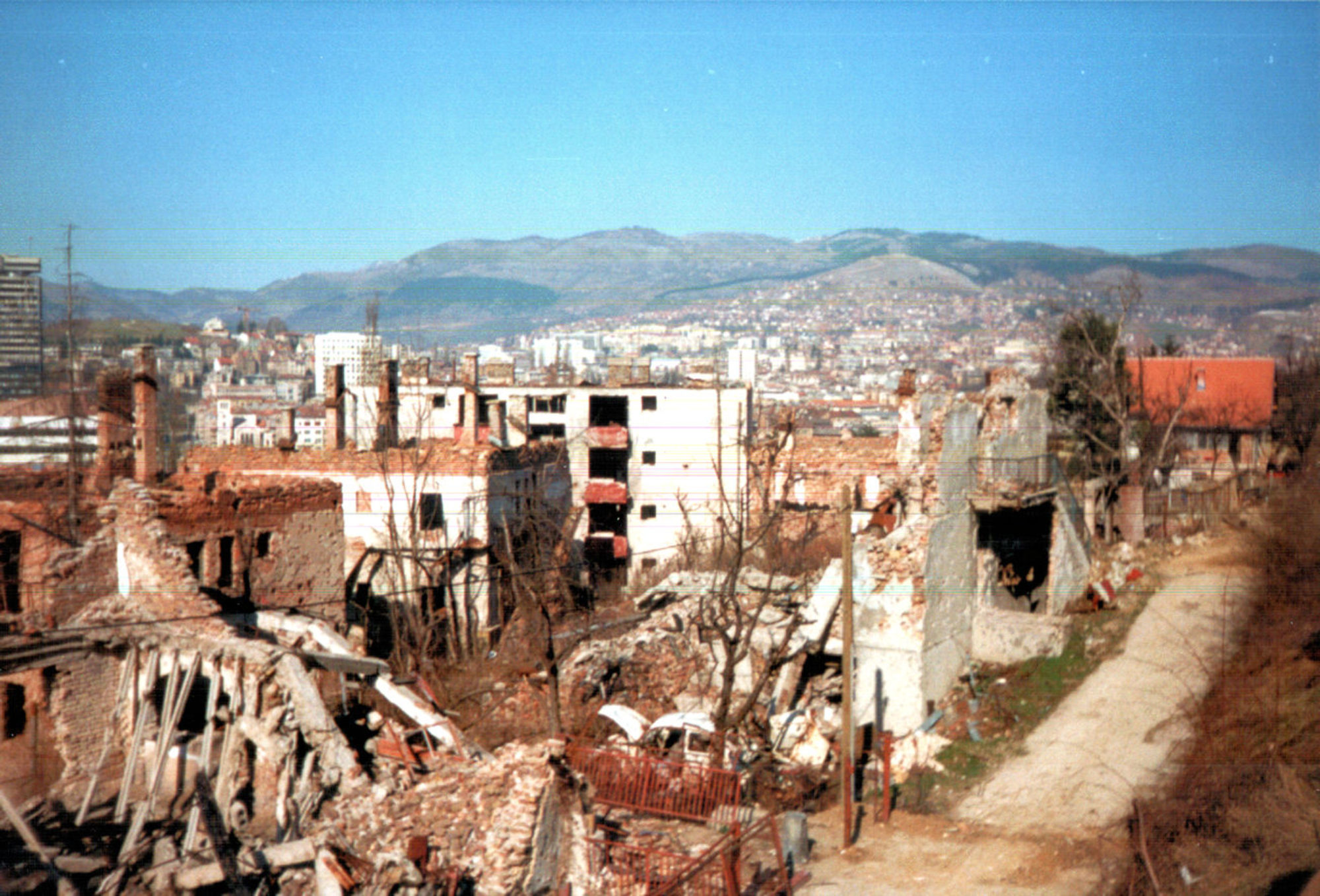
In 1858, Miloš and Mihailo Obrenović came back from exile. This week, we’ll see what they got up to second time round.
Also, there are now maps!
Theme Music – “Charlotte” by Damiano Baldoni, licensed under CC BY 4.0
Home of ‘The History of Yugoslavia’ podcast
In 1858, Miloš and Mihailo Obrenović came back from exile. This week, we’ll see what they got up to second time round.
Also, there are now maps!
Theme Music – “Charlotte” by Damiano Baldoni, licensed under CC BY 4.0
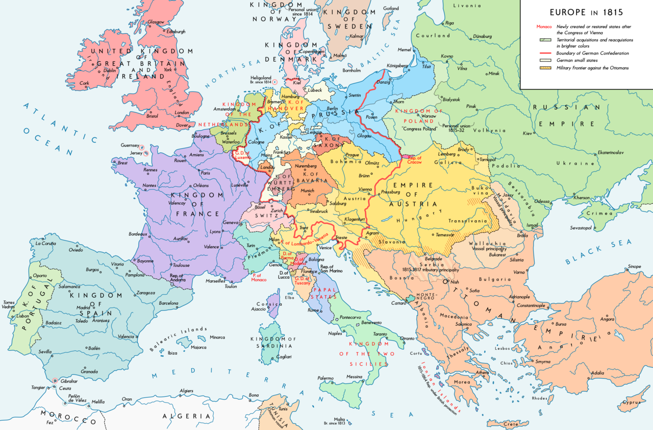
So, I’ve just realised that I’m mentioning a lot of countries and places, and you might not fully understand where these all are in relation to each other. So here’s a selection of maps which should hopefully help with understanding the geography, at least at a political level.
First off, here are four maps of Europe at various dates through the 19th Century. All have been excellently produced by Wikipedia user KaterBegemot. All licensed under CC BY 4.0


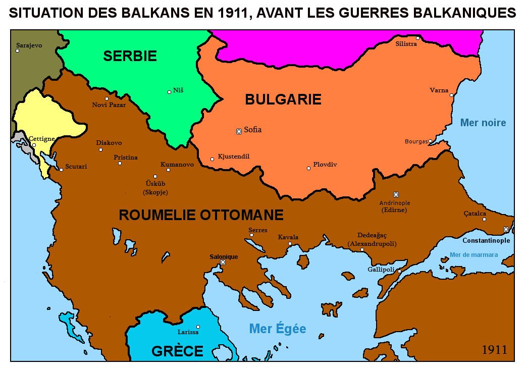
The next few maps deal specifically with the episodes on the Balkan Wars of 1912-13 (Wiki authors or other source credited in captions).


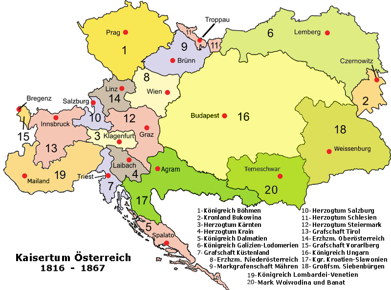
Next, a map of the component map of the Austrian Empire, courtesy of Wikipedia user Spiridon Ion Cepleanu:
Aurel Popovici’s plan for reforming the Habsburg Empire, 1906 (Author – Andrei nacu):

A map of the oblasts (which I refer to in the podcast as “districts”) of the Kingdom of Serbs, Croats and Slovenes after the passage of the 1921 Vidovan Constitution, credit to Wiki user PANONIAN:

A map of Hungarian territories lost in the Treaty of Trianon and their ethnic composition. Credit to Wiki users Fz22 and CoolKoon:

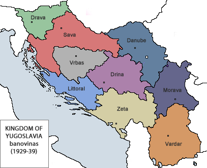
A map of the banovine/provinces of the Kingdom of Yugoslavia after 1929, credit to Wiki user Bukkia:
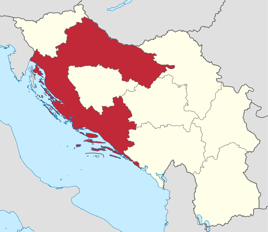
And a map of the Banovina of Croatia, by Wiki users NordNordWest and Flappiefh
Download Episode!
Today, we get up to speed on what’s been happening up until the 1850s in Serbia’s neighbour, Montenegro.
Theme Music – “Charlotte” by Damiano Baldoni, licensed under CC BY 4.0
This episode, we take a look at developments in Serbia under the reign of the much-maligned Prince Alexander Karađorđević, and the origins of the Serb ethnic nationalist movement.
Theme Music – “Charlotte” by Damiano Baldoni, licensed under CC BY 4.0
After becoming Prince of Serbia in 1817, Miloš Obrenović set about consolidating his position as an autocratic ruler. Further to the South, the Greeks start to get restless too….
Finally, time to get the first of the countries that will become Yugoslavia on the board, as a bunch of disgruntled Janissaries inadvertently provoke the creation of modern Serbia.
This week’s episode explores the background to the Balkan national independence movements – the Ottoman Empire. Enjoy, and any comments or feedback are appreciated!
In this Introductory episode, I explain the concept of this podcast and give a lightning summary of Balkan history up to the 18th Century. Hope you enjoy it!