So, I’ve just realised that I’m mentioning a lot of countries and places, and you might not fully understand where these all are in relation to each other. So here’s a selection of maps which should hopefully help with understanding the geography, at least at a political level.
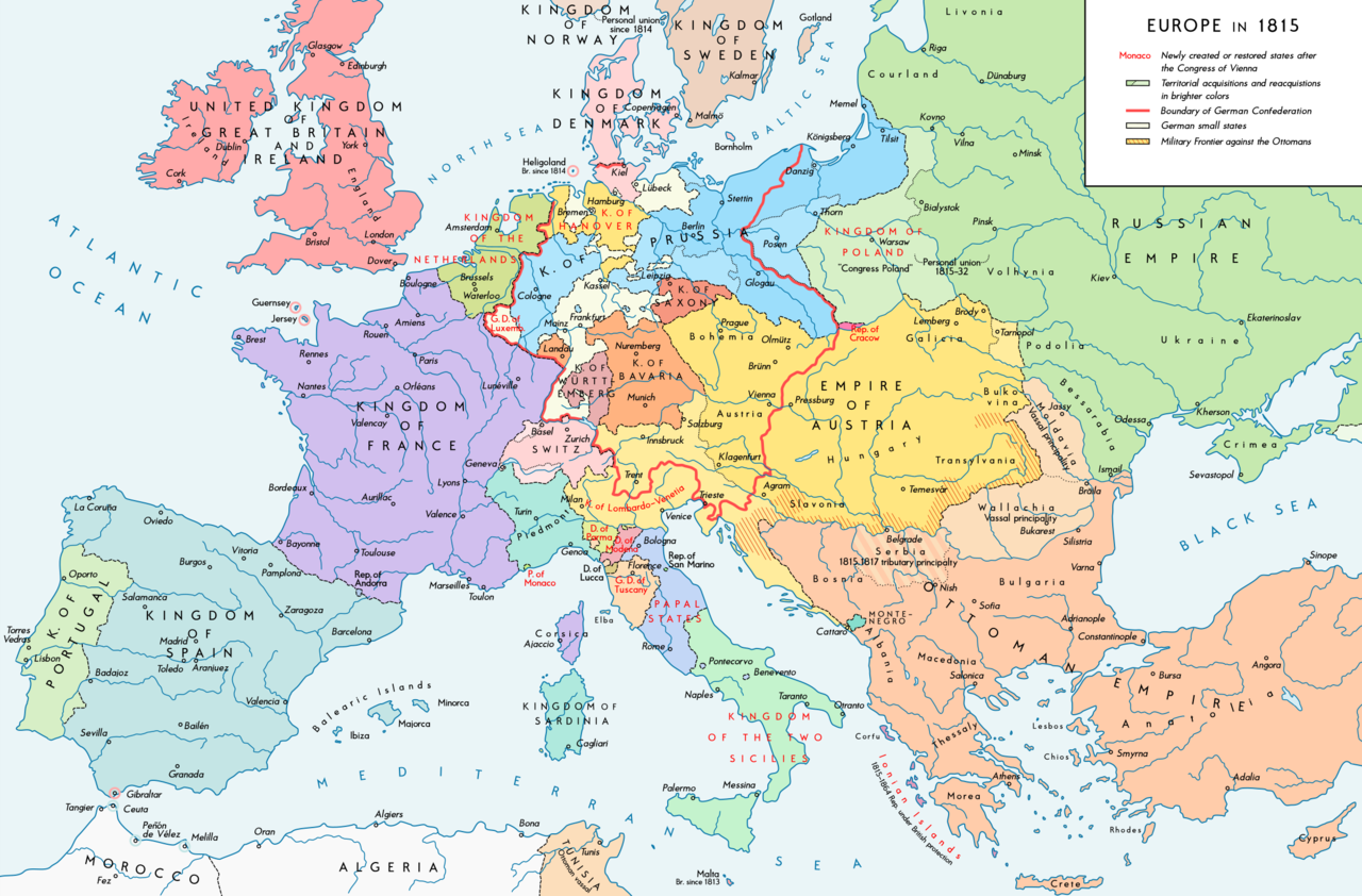
First off, here are four maps of Europe at various dates through the 19th Century. All have been excellently produced by Wikipedia user KaterBegemot. All licensed under CC BY 4.0


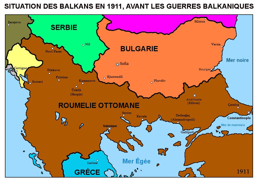
The next few maps deal specifically with the episodes on the Balkan Wars of 1912-13 (Wiki authors or other source credited in captions).


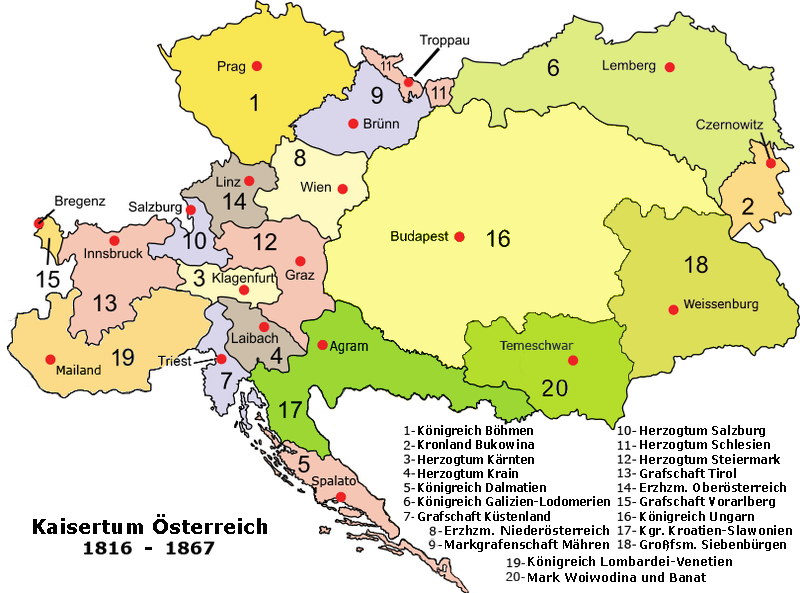
Next, a map of the component map of the Austrian Empire, courtesy of Wikipedia user Spiridon Ion Cepleanu:
Aurel Popovici’s plan for reforming the Habsburg Empire, 1906 (Author – Andrei nacu):

A map of the oblasts (which I refer to in the podcast as “districts”) of the Kingdom of Serbs, Croats and Slovenes after the passage of the 1921 Vidovan Constitution, credit to Wiki user PANONIAN:

A map of Hungarian territories lost in the Treaty of Trianon and their ethnic composition. Credit to Wiki users Fz22 and CoolKoon:

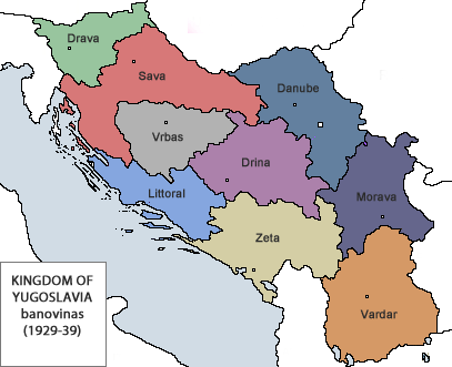
A map of the banovine/provinces of the Kingdom of Yugoslavia after 1929, credit to Wiki user Bukkia:
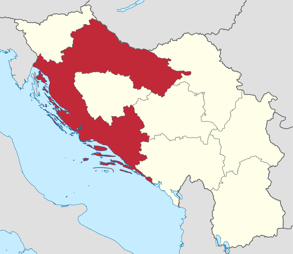
And a map of the Banovina of Croatia, by Wiki users NordNordWest and Flappiefh
Hello
I was waiting and wondering if my surname Brankovic would pop up in these podcasts somewhere in Serbian or Kosovo History? Just curious thats all. Love the show, listening all the way from Australia.
Hey Nik, apologies about taking a while to reply!
I’ve had a bit of a look ahead, and unfortunately I don’t think there’ll be any Brankovićs coming up in the podcast, though if I turn out to be wrong, I’ll point it out.
There was a Branković dynasty that ruled Serbia in the early 15th Century though, just before the final Ottoman Conquest.
Thanks for listening, glad you like the show!
First of all, great job on the podcast. Found out about it last week, already at its 20th episode. Plan to donate as soon as I get my paycheck.
Anyway, I have an interesting historic person you can look into (i think you cant fit him in the podcast, but he is interesting to read about) its Jovan Nenad, a self proclaimed king of the “Second” Serbian Empire that existed in the 16th century in Vojvodina. The capital was my hometown, Subotica. He put foundations for the idea of Vojvodina being separate from the Habsburg monarchy Also, the guy was mentioned in a old USA movie from the 40s (Cat people), which was funny.
All the best.